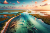
When current hits offshore structure, cold nutrient-rich water rises toward the surface. That localized upwelling compresses bait and predators into defined zones. This article breaks down which structures create the strongest upwelling, how to read the signs before and during a trip, and how to position and present baits where predators actually feed.
How to Fish Upwelling Around Offshore Structure
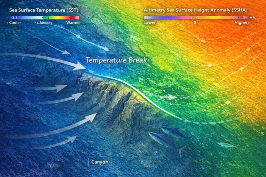
The night before a canyon trip, you pull up altimetry data and notice a low sea-surface-height anomaly sitting right over a ledge you have been watching all season. SST confirms a two-degree temperature break on the upcurrent face. Chlorophyll levels are elevated. You just found the intersection of structure, current, and upwelling, and that intersection is where the food chain stacks from bottom to top.
Structure alone holds fish. Upwelling alone attracts bait. When they work together, the result is a compressed feeding zone where phytoplankton, baitfish, and apex predators occupy the same vertical column over a piece of bottom you can target with precision. Understanding how this system works, and how to read it, position for it, and present baits within it, separates anglers who consistently find the bite from those who troll past it.
What Is Upwelling and Why Does It Concentrate Fish Around Structure?
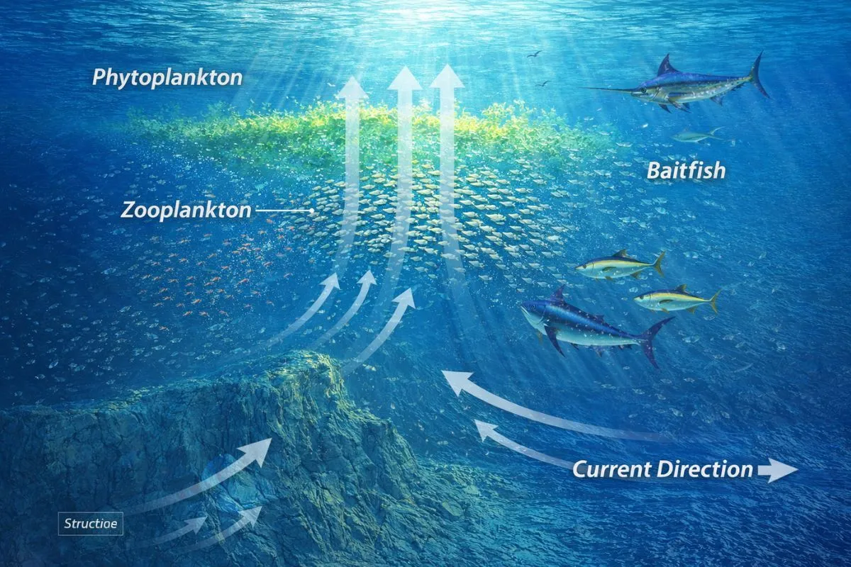
Upwelling is the upward movement of cold, nutrient-rich water from the deep ocean toward the surface. Wind, the Coriolis effect, and current deflection off bottom topography all drive this process. When that deep water reaches sunlit surface layers, the nutrients fuel explosive phytoplankton growth. Zooplankton feed on the phytoplankton. Baitfish feed on the zooplankton. Predators follow the bait. The entire food chain activates in a concentrated area.
The scale of this effect is hard to overstate. Coastal upwelling zones cover roughly one percent of the ocean's surface area but produce about 50 percent of the world's fisheries landings, according to NOAA. For offshore anglers, the practical takeaway is straightforward: upwelling transforms a piece of bottom structure from a spot that might hold a few resident fish into a zone where the food chain is stacked vertically and feeding is aggressive.
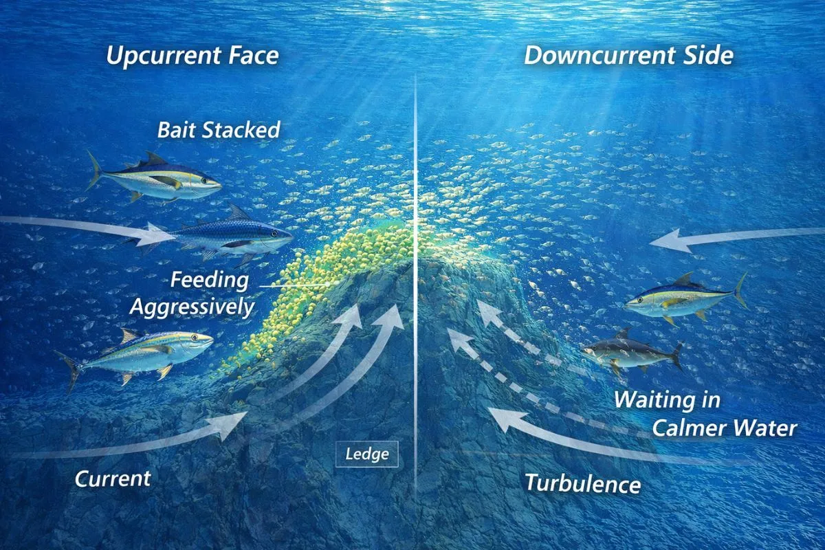
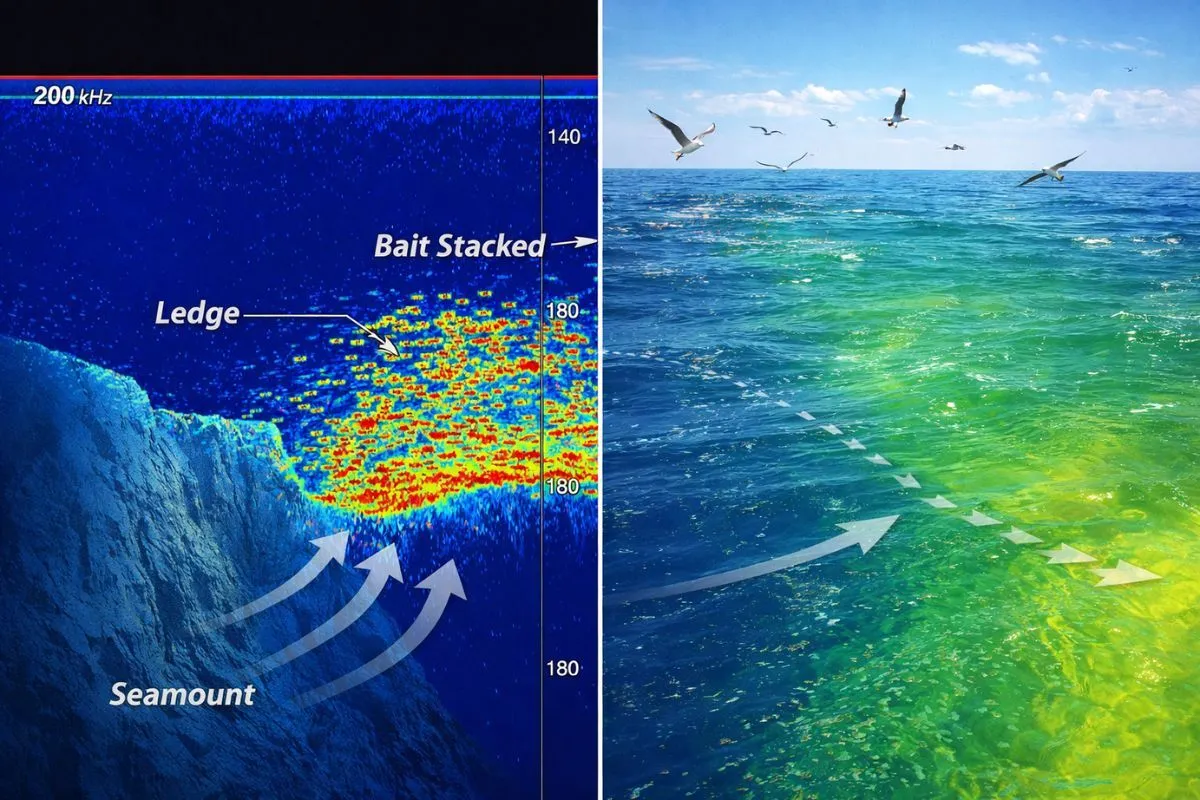
What makes upwelling so powerful around structure specifically is the interaction between horizontal current and vertical relief. When current flowing horizontally encounters a seamount, ledge, canyon wall, or ridge, the water has to go somewhere. It goes up. That vertical acceleration pulls nutrient-loaded deep water into the productive upper layers and pins bait against the structure. Predators know this. They position accordingly.
What Types of Structure Create Fishable Upwelling?
Not all structure generates meaningful upwelling. The effect depends on the size and orientation of the feature, the strength and direction of the current, and the depth differential between the structure's peak and the surrounding bottom. The structures that matter most to offshore anglers fall into several categories.
Natural Structure
Seamounts and banks are subsurface peaks that project above the surrounding seafloor and deflect deep currents upward. They carry above-average plankton populations and act as biological hotspots where fish that feed on plankton aggregate, drawing larger predators. The Gordo Banks off Cabo San Lucas illustrate this perfectly: currents hit rock formations, nutrients rise to the surface, baitfish concentrate, and pelagics from yellowfin tuna to blue marlin follow. Cashes Ledge off Maine operates on the same principle, with an underwater mountain range rising to just 24 feet below the surface, generating upwelling that attracts tuna, sharks, and whales.
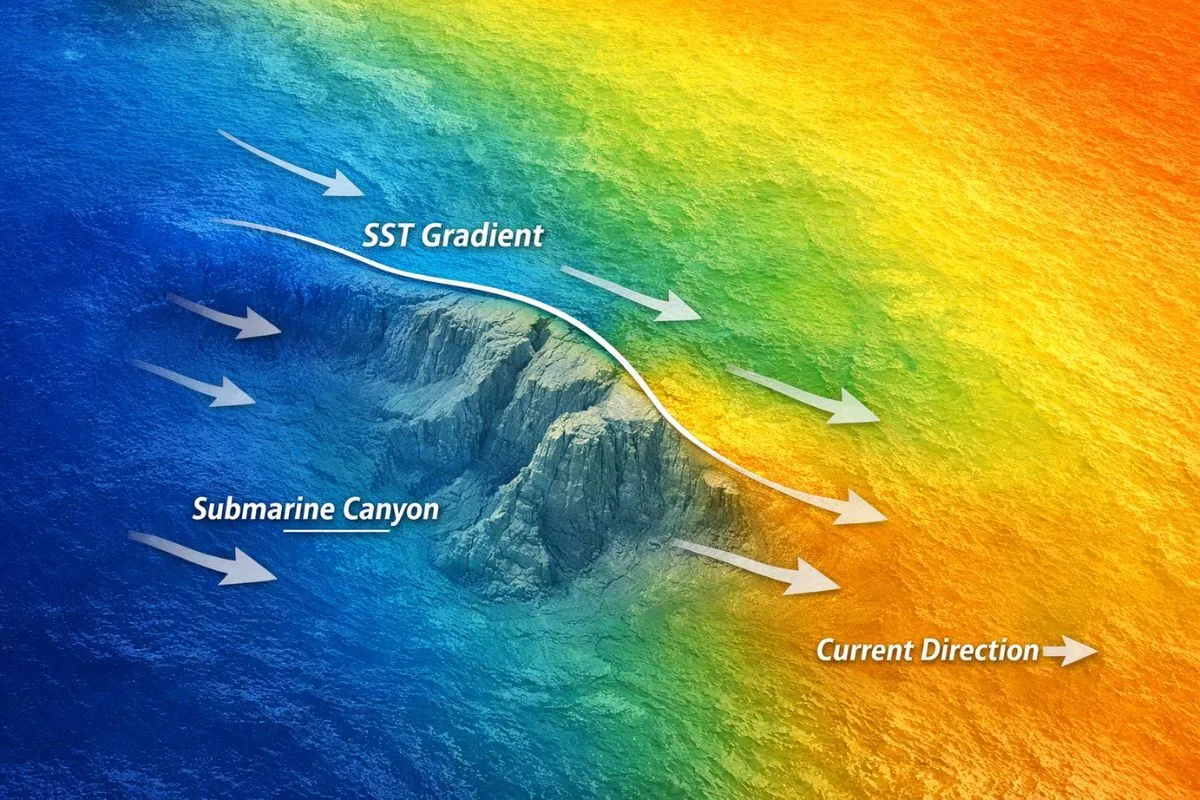
Submarine canyons force current upward when flow pushes from deeper water into a steep wall. The Mid-Atlantic canyons (Hudson, Norfolk, Baltimore, Washington) are prime examples. When a Gulf Stream eddy pushes warm water from deep to shallow against the 100-fathom curve at Hudson Canyon, the result is an upwelling effect that drives bait toward the surface and creates the kind of temperature break anglers can see on SST charts and with their own eyes on the water.
Man-Made Structure
Oil and gas platforms in the Gulf of Mexico number in the thousands and span depths from nearshore to over 6,000 feet. These structures provide vertical habitat from surface to bottom in a footprint only a few hundred feet wide. Surveys have shown that fish numbers around the conductors (the vertical pipes running from the drill deck into the water) are substantially higher than around other parts of the structure. Platforms do not generate their own upwelling, but they interact with current flow and concentrate the effects of broader upwelling patterns, making them magnets for bait and predators alike.
What Conditions Make Upwelling Stronger or Weaker?
Understanding what amplifies or suppresses upwelling helps you predict which days and which structure will fish best.
Current strength and stability are the primary drivers. Upwelling intensity depends on how hard the current pushes against the structure and how long that push persists. Conditions that hold steady for 72 hours or more produce significantly better fishing than short-lived upwelling events, because the food chain needs time to activate. Too much current, however, can blow bait past the structure entirely. Too little means insufficient vertical lift to concentrate the food chain.
El Nino and La Nina directly affect upwelling productivity. El Nino weakens trade winds and deepens the thermocline, suppressing upwelling across entire regions. Expect reduced productivity around structure during strong El Nino years. La Nina strengthens normal upwelling patterns, often improving fishing on structure across the board.
Thermocline depth determines how visible the upwelling effect is to both anglers and fish. A shallow thermocline produces temperature breaks and bait aggregation near the surface that you can see and fish easily. A deep thermocline (common in late summer or during El Nino) means the upwelling effect plays out at depth. Fish and bait hold lower around the structure, and surface clues may be absent entirely.
How Do You Read Upwelling Around Structure Before and During a Trip?
Pre-Trip: Layering Satellite Data
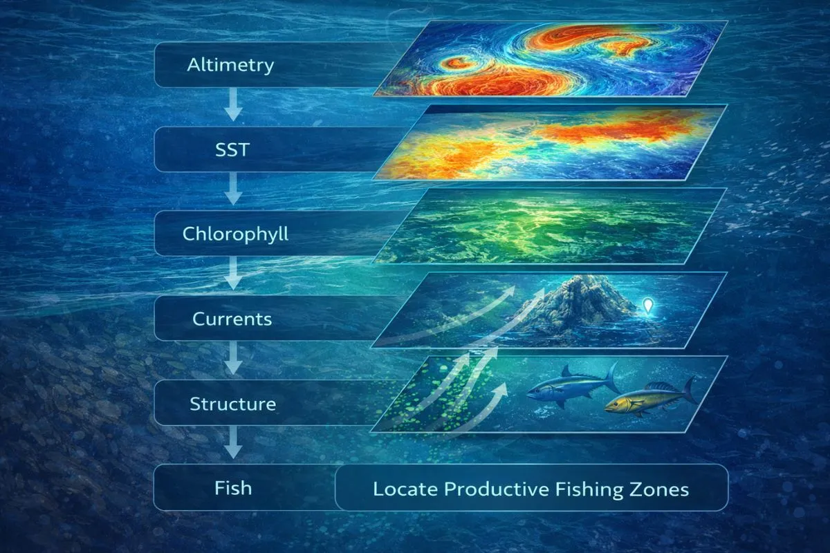
The most productive approach works through satellite data in a specific order:
- Altimetry first. Areas with lower sea-surface height indicate upwelling (nutrients rising). Higher readings indicate downwelling (nutrient-poor). The boundary between the two is your starting point. This is the single most overlooked data layer in offshore fishing.
- SST for precision. Identify temperature breaks where cooler upwelled water meets warmer ambient water. The edges of these breaks concentrate bait and predators. Features that have been stable for three or more days are the most productive.
- Chlorophyll for confirmation. Elevated chlorophyll signals phytoplankton blooms fueled by upwelling nutrients. When chlorophyll aligns with a temperature break over a known piece of structure, you have convergence.
- Bathymetry overlay. Cross-reference all of the above with bottom contour data. When a temperature break lines up with a steep ledge, seamount, or canyon wall, that is your primary target for the trip.
For step-by-step instruction on interpreting these data layers, see How to Read SST Charts for Fishing and Fishing Temperature Charts.
On the Water: Visual and Electronic Clues
Once you arrive at the structure, confirm what the satellite data told you.
Surface signs include color changes (blue to green or turbid), rips and foam lines where water masses collide, Sargassum accumulation along boundaries, and bait activity such as dimpling, showering, or nervous water. Birds working an area or hovering over apparently quiet water indicate bait concentration below.
Electronics tell you what is happening in the water column. Look for bait stacked on the upcurrent face of the structure, showing as dense marks at specific depth bands rather than scattered returns. Watch for thermocline distortion near the structure, which indicates active upwelling bending the thermal layers. Use your bottom machine to confirm the shape and orientation of the structure relative to current direction.
Where Do Fish Position Relative to Upwelling and Structure?
How Do Pelagic Predators Use Upwelling Zones?
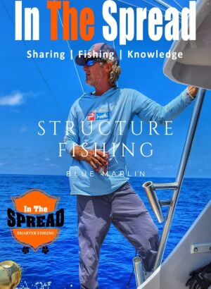
Blue marlin, yellowfin tuna, wahoo, and mahi position predictably around upwelling structure rather than roaming randomly. Marlin patrol the upcurrent face and shoulders of structure where current and upwelling interact with bottom topography to concentrate baitfish. They use the vertical lift of the upwelling to ambush prey being pushed toward the surface. For a detailed breakdown from one of the best in the business, see Fishing Structure for Blue Marlin with Kevin Hibbard.
Yellowfin tuna move in cyclical patterns around seamounts and banks, leaving and returning on a predictable schedule. The feeding behavior repeats. If you find the right structure with active upwelling and establish yourself as the food source through chumming, the fish come back. See Yellowfin Tuna Fishing for tactics on making that work.
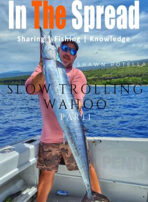
Wahoo cruise deeper in the water column around temperature breaks and current edges near structure. They are ambush predators that prefer subsurface action, making planers and weighted rigs critical presentations around upwelling zones. See Slow Trolling Wahoo for effective approaches.
How Do Reef Predators Respond to Upwelling?
Amberjack suspend in the water column on the upcurrent face of wrecks and ledges, using the current to intercept bait swept along the structure. Grouper hold tighter to the bottom but position on the upcurrent edge of ledges and overhangs where current funnels food directly to them. Snapper behavior varies with current speed. On light-current days around platforms, big snapper may prowl 50 yards from the structure. On heavier current days, they tuck in tight.
Learn Strucutre Fishing

How Should You Position the Boat Around Upwelling Structure?
Boat positioning is where most anglers lose the advantage that upwelling provides. The single most important principle: align your approach with the current, not the wind. Current determines where bait goes and where fish face. Wind affects boat handling but has almost no influence on fish positioning.
Setting Up by Current Speed
In light current (under 1 knot), the upwelling signature is subtle. Temperature differentials may be less than one degree. Bait marks on the sounder are scattered rather than stacked, and fish spread out along the structure. Use longer drifts covering more of the feature with baits at multiple depths. Lighter weights and more natural presentations are effective. Cover ground methodically until you find the active zone.
In moderate current (1 to 2 knots), the upwelling is pushing bait into defined bands on the upcurrent face and shoulders. This is the sweet spot. For trolling, run passes along the shoulder where the temperature break is sharpest. For vertical work, position on the upcurrent shoulder and drop jigs into the lift zone where bait is stacking. Fish are concentrated and feeding actively.
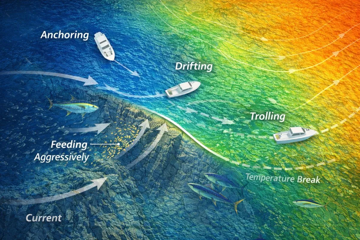
Anchored, Drifting, or Trolling?
Anchoring works best on small, productive features like a wreck, isolated rock pile, or specific ledge. Set your anchor so you sit upcurrent of the structure, letting baits sweep naturally back into the fish-holding zone. Fish face into current and expect food from that direction. Position so current carries your baits into their field of view.
Drifting covers more ground and works well over extended ledges and reef systems. Set up upcurrent and let the flow carry you across productive contours. Deploy a drift sock if speed is too high. Maintain bottom contact throughout. When you cross a productive zone, mark it and reset for another pass.
What Presentations Work Best in Upwelling Zones?
Live bait should be rigged with enough weight to drift naturally into the upwelling zone at the depth where bait is marking. Stagger baits across the water column. Let the current carry them along the face of the structure so they look like forage being swept through the area, not pinned in place.
Vertical jigs are deadly on the upcurrent face and shoulders during active upwelling. Drop to the depth band where bait is concentrated and work up through the column. Flutter jigs and slow-pitch jigs excel when fish are keyed on smaller bait being pushed upward. Speed jigs work when fish are aggressive and chasing larger forage. In heavy current, move up to 10- to 16-ounce jigs to maintain bottom contact and stay in the strike zone.
Trolling spreads should be adjusted for depth. If the upwelling is strong and bait is near the surface, standard positions work. If the thermocline is deep and bait is holding lower, use planers or deep-diving plugs to reach the strike zone. Mix presentations: active lures on the short corner for billfish, smoke-trail lures on the long corner for tuna, wire-rigged baits for wahoo.
Common Mistakes When Fishing Upwelling Around Structure
Setting up directly over the structure instead of upcurrent. You spook fish and your baits land behind them. Fish face into the current. Get above them and let your presentation flow naturally into their line of sight.
Ignoring current direction in favor of wind comfort. The boat rides better at certain wind angles, but fish do not care about your comfort. Current dictates their positioning and yours.
Leaving too quickly before adjusting. You found the right structure with the right upwelling signature. Before pulling the plug, try a different drift angle, a different depth, or a different presentation. Moving to a new spot means starting the search over.
Frequently Asked Questions About Fishing Upwelling and Structure
What is the best type of structure for upwelling fishing?
Seamounts and submarine canyon walls generate the strongest localized upwelling because their steep vertical relief forces horizontal current sharply upward. Any structure with significant depth change relative to the surrounding bottom can produce fishable upwelling when current conditions are right.
How do you identify upwelling on SST charts?
Look for areas of cooler water adjacent to warmer ambient water, especially along bottom contour lines. Cross-reference with altimetry data: areas with lower sea-surface height correspond to upwelling zones. When both data layers align over known structure, you have a high-probability target.
Does upwelling fishing work year-round?
In tropical waters with consistent current, yes. In temperate zones, upwelling around structure is strongest in spring and summer when temperature contrast between deep and surface water is greatest. El Nino years suppress upwelling broadly, while La Nina years strengthen it.
Which side of the structure should you fish?
In light to moderate current, fish the upcurrent face and shoulders where the upwelling effect is strongest and bait concentrates. In heavy current, the downcurrent side becomes productive as bait tumbles over the structure into calmer water where predators wait.
Why is my sounder showing bait on the structure but I am not getting bites?
You are likely fishing at the wrong depth in the column or approaching from the wrong angle relative to the current. Check where bait is densest on your sounder, adjust your presentations to that depth band, and reposition upcurrent so your baits flow naturally into the feeding zone.
Putting It All Together
Structure, current, and upwelling operate as a single interconnected system, not three separate factors. The angler who reads all three together and positions accordingly is fishing the highest-percentage water available on any given day. Start logging GPS tracks, current direction, water temperature at the structure, and your results. The patterns emerge over time, and the learning curve gets shorter with every trip.
Seth Horne Founder, CEO, and Chief Fishing Educator at In The Spread
Login
to leave a review.
User Reviews
There are no reviews yet.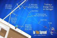
Complete Dredge Pulley Setup Guide
Saltwater
12.28.2020
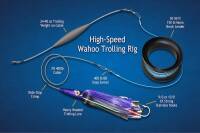
High Speed Wahoo Trolling Rig
Saltwater
09.08.2018
Fishing Light Tackle for Yellowfin Tuna
Saltwater
09.08.2018
Fishing Gulf of Mexico Inshore Waters
Saltwater
11.28.2023
0