Satellite altimetry technology transforms offshore fishing by revealing underwater current patterns invisible to traditional methods. Anglers using this scientific approach consistently locate productive upwelling zones where game fish concentrate, achieving higher catch rates and significant fuel savings.
How to Use Altimetry Fishing Charts and Satellite Maps
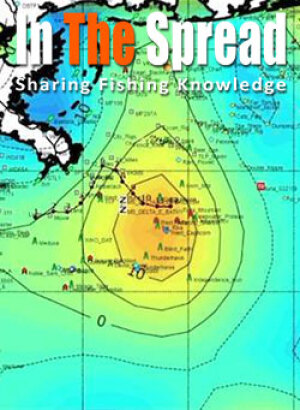
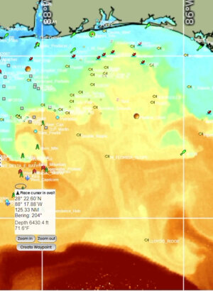
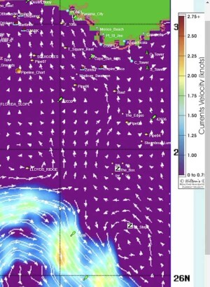
Altimetry Fishing Charts
Professional anglers consistently outperform weekend warriors not because of luck, but because they understand where fish concentrate before ever leaving the dock. Altimetry fishing represents the cutting edge of this scientific approach, using satellite map technology to identify the most productive fishing zones on any given day.
Understanding the Science Behind Altimetry Fishing
Satellite altimetry measures the height of the ocean surface from space, revealing underwater dynamics invisible to the naked eye. These measurements detect variations as small as a few centimeters across vast ocean areas, providing unprecedented insight into marine ecosystems.
When satellites measure sea surface height, they're essentially mapping the ocean's three-dimensional structure. Areas where water appears elevated or depressed indicate powerful currents moving vertically through the water column. These vertical movements transport nutrients, plankton, and ultimately the entire food chain.
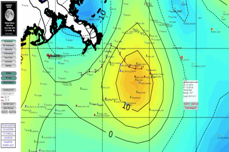
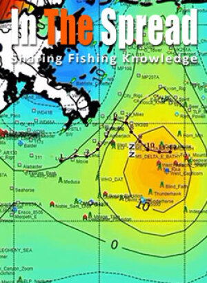
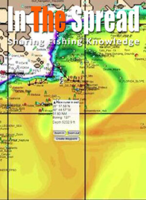
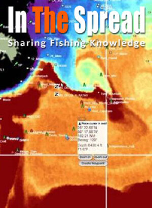
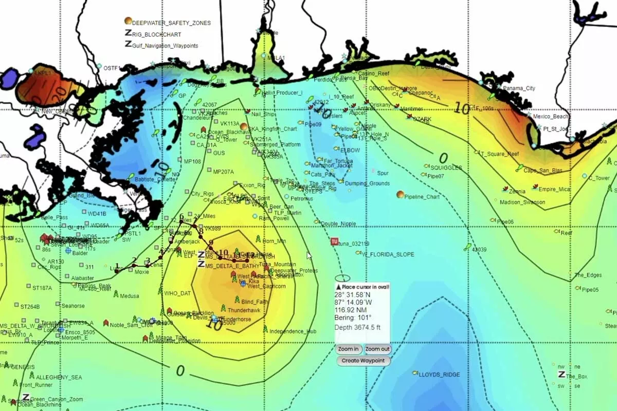
The color-coded satellite maps display this data in an easily readable format:
- Blue zones indicate upwelling areas where nutrient-rich water rises to the surface
- Yellow and orange zones show downwelling areas where surface water sinks
- Green transitions mark the edges where different water masses meet
- Sharp color contrasts often indicate the most productive fishing boundaries
Courses on Reading Satellite Maps for Fishing
The Ocean Food Chain Connection
Marine ecosystems operate on a simple but powerful principle: nutrients drive everything. Microscopic plankton forms the foundation of oceanic food webs, supporting every fish species anglers target. These tiny organisms drift with currents, concentrating wherever nutrient-rich water reaches the surface.
Upwelling zones create underwater highways where life moves vertically through the water column. When deep, cold water rich in dissolved nutrients gets forced upward, it triggers explosive plankton blooms. Small baitfish follow these blooms to the surface, creating dense feeding opportunities that attract larger predators.
This feeding hierarchy builds systematically:
- Phytoplankton bloom in nutrient-rich upwelled water
- Zooplankton feed on phytoplankton in massive concentrations
- Baitfish schools gather to feed on zooplankton near the surface
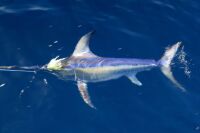
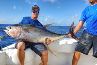
- Pelagic predators like tuna, dolphin, and marlin arrive to hunt baitfish
Identifying Productive Upwelling vs. Unproductive Downwelling
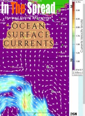
Ocean currents function as conveyor belts transporting nutrients and marine life across vast distances. The earth's rotation drives these massive water movements, creating predictable patterns that satellite altimetry can track and map in real-time.
Upwelling areas represent fishing gold mines because they bring deep-water nutrients to depths where light can penetrate. This combination of nutrients and sunlight triggers the photosynthesis that powers marine food webs. Fish concentrate in these zones because that's where their food sources naturally gather.
Downwelling zones tell the opposite story. Surface water sinks in these areas, taking potential food sources deeper where they become less accessible to surface-feeding species. Smart anglers use altimetry data to avoid these unproductive zones entirely, focusing their limited fishing time on proven upwelling areas.
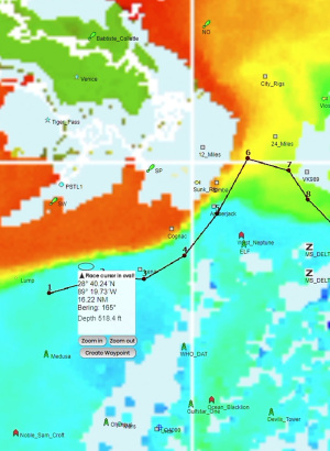
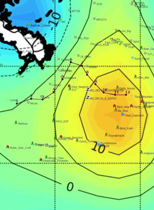
The most productive fishing often occurs where different water masses collide:
- Current boundaries where upwelling meets downwelling water
- Temperature breaks visible on satellite sea surface temperature maps
- Chlorophyll edges showing plankton concentration gradients
- Depth changes where underwater structure influences current flow
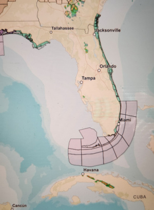
Gulf of Mexico Case Study: Real-World Current Dynamics
The Gulf of Mexico provides an excellent example of how complex current systems create constantly changing fishing opportunities. Understanding these dynamics helps explain why satellite altimetry proves so valuable for Gulf fishing success.
Atlantic Ocean water rotates clockwise above the equator, creating the massive equatorial current that flows east to west. This enormous volume of water collides with South America's northeast coast, forcing huge amounts through the Caribbean basin and up past Mexico's Yucatan Peninsula.
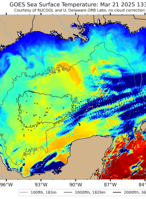
As this Caribbean water squeezes through the narrow Yucatan Channel, it accelerates and pours into the Gulf of Mexico with tremendous force. Here it collides with freshwater outflow from the Mississippi River system, creating the famous Loop Current that dominates Gulf fishing patterns.
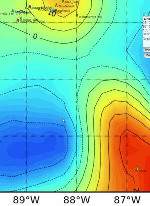
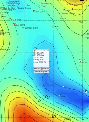
This collision generates multiple effects that altimetry satellites can track:
- Massive eddies spin off from the main Loop Current
- Counter-currents form along the edges of these eddies
- Upwelling zones develop where currents hit underwater structure
- Convergence lines concentrate floating debris and baitfish
The Gulf's complex bottom topography adds another layer of current interaction. Underwater ridges, valleys, and oil platforms deflect these powerful currents, creating localized upwelling and downwelling zones that shift position based on current strength and direction.
Reading Satellite Map Services Like a Professional
Modern fishing success requires integrating multiple types of satellite oceanographic data rather than relying on any single measurement. Professional captains typically monitor three key data streams that work together to identify optimal fishing conditions.
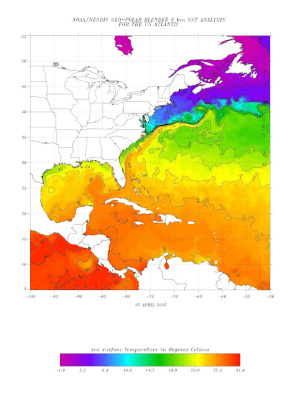
Sea Surface Temperature (SST) data reveals the thermal structure of surface waters. Different fish species prefer specific temperature ranges, making SST charts essential for targeting particular species. Marlin in the Gulf typically prefer water between 78-84°F, while yellowfin tuna often relate to slightly cooler water in the 76-80°F range.
Altimetry readings provide the third piece of the puzzle by revealing water movement patterns invisible to temperature and chlorophyll sensors. The most successful fishing typically occurs where all three data types align:
- Optimal temperature ranges for target species
- Moderate to high chlorophyll concentrations indicating active food webs
- Upwelling altimetry signatures showing vertical water movement
- Sharp gradients between different water masses
Practical Application for Tournament and Recreational Success
Pre-trip planning using satellite data can transform your fishing efficiency. Most successful captains check updated satellite information 2-3 days before departure, looking for developing patterns rather than just current conditions. Ocean dynamics change constantly, but understanding trends helps predict where conditions will be optimal during your actual fishing time.
Creating a priority zone strategy helps maximize limited fishing time. Instead of running to a single GPS coordinate, identify 3-4 areas showing promising satellite signatures. This approach provides backup options if your primary zone doesn't produce, and allows you to make strategic moves based on real-time observations.
Tournament fishing demands aggressive time management that satellite data makes possible. Professional tournament teams report these common time-saving strategies:
- Eliminate unproductive water by avoiding obvious downwelling zones
- Focus search patterns in confirmed upwelling areas
- Plan efficient routes between multiple promising zones
- Reduce fuel costs through targeted rather than random searching
Species-Specific Satellite Strategies
Different pelagic species respond to varying combinations of oceanographic conditions, making species-specific satellite interpretation crucial for consistent success. Understanding these preferences helps refine your satellite analysis for targeting particular fish.
Blue marlin typically relate to specific combinations of temperature and altimetry conditions. They prefer the warm side of temperature breaks, often in 80-84°F water, but seem most active near upwelling zones that bring baitfish to the surface. Look for areas where SST shows optimal temperatures adjacent to blue altimetry signatures indicating upwelling.
Dolphin fish or mahi mahi respond strongly to floating debris and structure, but satellite data helps locate the types of currents that concentrate these features. Convergence zones where different currents meet naturally collect floating objects that attract dolphin. These areas often show as transition zones on altimetry charts.
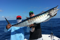
Wahoo prefer current edges and seem particularly active where upwelling zones meet structure or temperature breaks. High-speed trolling for wahoo becomes much more effective when confined to satellite-identified productive zones rather than randomly covering water.
Advanced Techniques for Consistent Success
Seasonal pattern recognition dramatically improves satellite interpretation skills. Ocean currents follow annual cycles influenced by weather patterns, making historical data valuable for understanding current conditions. Experienced captains maintain logbooks correlating satellite conditions with fishing success, building databases that improve decision-making over time.
The most successful satellite fishing combines modern technology with traditional knowledge. Water color observations, bird activity, and surface conditions help verify satellite predictions while providing real-time adjustments. When satellite data conflicts with observable conditions, trust what you can see and adjust accordingly.
Weather systems significantly influence current patterns and satellite readings. Storm systems can temporarily disrupt established current patterns, while high-pressure systems often strengthen existing upwelling zones. Learning to factor weather influences into satellite interpretation separates advanced practitioners from beginners.
Professional guides emphasize these key principles for satellite fishing success:
- Verify data accuracy by cross-referencing multiple satellite services
- Understand lag times between data collection and map updates
- Focus on edges and transitions rather than uniform areas
- Combine multiple data types rather than relying on single measurements
- Keep detailed records to build experience-based interpretation skills
Maximizing Your Return on Investment
Satellite service costs range from free basic services to premium subscriptions costing several hundred dollars monthly. Most recreational anglers find excellent value in mid-tier services providing SST, altimetry, and chlorophyll data with updates every 1-2 days.
Tournament teams and professional captains often invest in premium services offering:
- Daily or twice-daily updates
- Higher resolution imagery
- Predictive modeling
- Mobile device compatibility
- Historical data archives
The return on investment becomes obvious quickly for serious anglers. Fuel savings alone often justify subscription costs, while improved catch rates and reduced search time provide additional value. Many captains report that satellite data pays for itself within 2-3 fishing trips through improved efficiency and success rates.
Building effective satellite fishing systems requires patience and practice. Start with basic services to learn interpretation fundamentals before investing in premium options. Focus on understanding the relationship between satellite conditions and actual fishing success in your local waters.
Taking Action: Your Next Steps
Altimetry fishing transforms random searching into strategic hunting by revealing the ocean's hidden structure. Success requires understanding how vertical water movements concentrate marine life, then using satellite technology to identify these productive zones before leaving the dock.
Start implementing these techniques immediately:
- Subscribe to a basic satellite service offering SST, altimetry, and chlorophyll data
- Study your local waters to understand typical current patterns and seasonal variations
- Record detailed logs correlating satellite conditions with fishing success
- Practice interpretation skills by comparing satellite predictions with actual fishing results
The investment in learning satellite fishing techniques pays dividends in reduced search time, lower fuel costs, and dramatically improved catch rates. Professional tournament anglers consider oceanographic data essential rather than optional, and recreational anglers who master these techniques consistently outperform those fishing randomly.
Master altimetry fishing systematically, and you'll join the ranks of anglers who consistently find fish while others struggle. The ocean's secrets become visible through satellite technology – learn to read these signals, and your fishing success will never again depend on luck.
Additional Resources on Satellite Maps for Fishing

Login
to leave a review.
User Reviews
There are no reviews yet.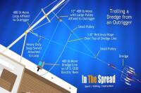
Complete Dredge Pulley Setup Guide
Saltwater
12.28.2020
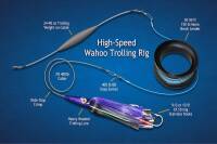
High Speed Wahoo Trolling Rig
Saltwater
09.08.2018
Fishing Light Tackle for Yellowfin Tuna
Saltwater
09.08.2018

Fishing Gulf of Mexico Inshore Waters
Saltwater
11.28.2023
0