fishing charts
Search fishing charts
GET WEEKLY TIPS
Start fishing better with FREE Weekly Video Tips delivered straight to your email.
fishing charts
FILTERS
-
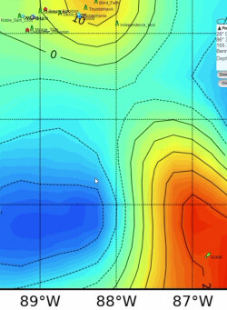
2023, Altimetry Data: Read the Ocean, Find More Fish
Sea surface height tells you more about where fish will be than most anglers realize. When you know how to read altimetry data alongside temperature and chlorophyll charts, you stop guessing and start targeting the specific oceanographic features that concentrate baitfish and gamefish offshore.
READ MORE -
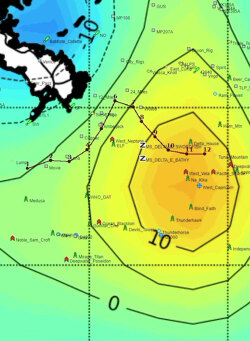
2020, How to Use Altimetry Fishing Charts and Satellite Maps
Satellite altimetry technology transforms offshore fishing by revealing underwater current patterns invisible to traditional methods. Anglers using this scientific approach consistently locate productive upwelling zones where game fish concentrate, achieving higher catch rates and significant fuel savings.
READ MORE
Showing 1 - 2 of 2 Results