AI fishing technology promises a lot. What it actually delivers depends on understanding the difference between genuine machine learning and sophisticated data visualization. That distinction changes how you evaluate every output these platforms give you and how much confidence you bring to your next offshore decision.
Using AI Technology to Find More Fish Offshore
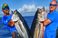
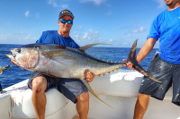
Walk the docks at any serious offshore port and you will hear captains talking about SST breaks, chlorophyll edges, and eddy walls. What you are also starting to hear is talk about which platforms they are running for satellite data, whether Starlink has changed how they work offshore, and what the new Garmin and Simrad units are actually doing that the old sounders were not. AI fishing technology is no longer a future conversation. It is a present one, and the captains getting the most out of it are the ones who are clear-eyed about what the technology actually does versus what the marketing says it does.
What AI Fishing Technology Actually Is (and What Most of It Is Not)
Let us be direct about something the marketing materials gloss over. Most of what gets labeled as AI in consumer fishing tools right now is not true artificial intelligence in the machine learning sense. It is a combination of rule-based modeling, human-tuned heuristics, and sophisticated data overlays. That does not make it useless. It makes it important to understand correctly.
Genuine machine learning in a fishing context means a system that adapts its predictions based on accumulated outcome data, identifies patterns too complex for humans to program manually, and improves over time through feedback. A handful of platforms are moving meaningfully in this direction. Most consumer tools are not there yet. What they are delivering is powerful data integration: pulling SST, chlorophyll, altimetry, current vectors, and bathymetry into a single display and letting you see relationships that would take hours to identify manually.
Understanding that distinction matters because it changes how you evaluate the output. A true ML system improves as more anglers contribute data. A rule-based overlay system gives you the same output regardless of what the fish did last trip. When a platform tells you its AI is learning your fishing patterns and personalizing recommendations, ask how many users and how many logged trips are actually behind that claim. The honest answer from most platforms is that aggregate data drives the output, not individual learning.
Offshore Data Tools and Where the Numbers Are Actually Stale
The most important practical gap between what offshore anglers expect from satellite data and what they actually receive is latency. The maps look current. They often are not.
Sea surface temperature data from passive microwave satellites can carry a six to twenty-four hour lag depending on cloud cover and the satellite's orbital pass schedule. Optical SST imagery degrades or disappears entirely under cloud cover, which is precisely when fronts and temperature breaks are developing. The image you are staring at may reflect conditions from yesterday morning.
Chlorophyll data lags further. Processing composite chlorophyll maps typically involves one to three days of accumulation to fill cloud gaps and smooth noise. The chlorophyll picture you use for trip planning is often a composite that smooths over recent shifts. Altimetry data, which drives eddy detection and sea surface height anomaly mapping, operates on a similar multi-day refresh cycle and is emphatically not real-time.
- Use satellite data for trip planning and pattern identification, not for pinpoint real-time positioning once you are offshore.
- Understand that a feature you see on a map may have shifted since the image was captured. Run toward the physics of where it should be, not where it was pictured.
- Cross-reference multiple data layers and dates to identify which features are stable versus which are actively shifting. Stable features fish better anyway.
The captains getting the most out of these platforms are not treating them like a live feed. They are using them to build a hypothesis about the ocean they are fishing, then going out and interrogating that hypothesis with their eyes and electronics. The data gives you a starting point. The ocean gives you the answer.
Reading SST, Chlorophyll, and Eddies the Right Way
Sea Surface Temperature: It Is About the Edge, Not the Color
Every offshore angler learns to follow the blue water. The refinement that separates consistent producers from optimistic ones is understanding that SST gradient edges matter far more than the temperature itself. A sharp temperature break, even one that sits slightly outside the theoretical comfort range for a target species, concentrates bait. Concentrated bait concentrates predators. The edge is the structure.
Chlorophyll Analysis: Fish the Edges, Not the Bloom
This is a correction to how most anglers interpret chlorophyll data. A high chlorophyll concentration is not automatically a productive fishing area. Dense phytoplankton blooms often mean turbid, low-visibility water that pelagic predators avoid. What you are looking for is the chlorophyll edge: the transition zone between productive biological water and cleaner offshore water. That edge concentrates baitfish and creates a definable boundary for predators to work along.
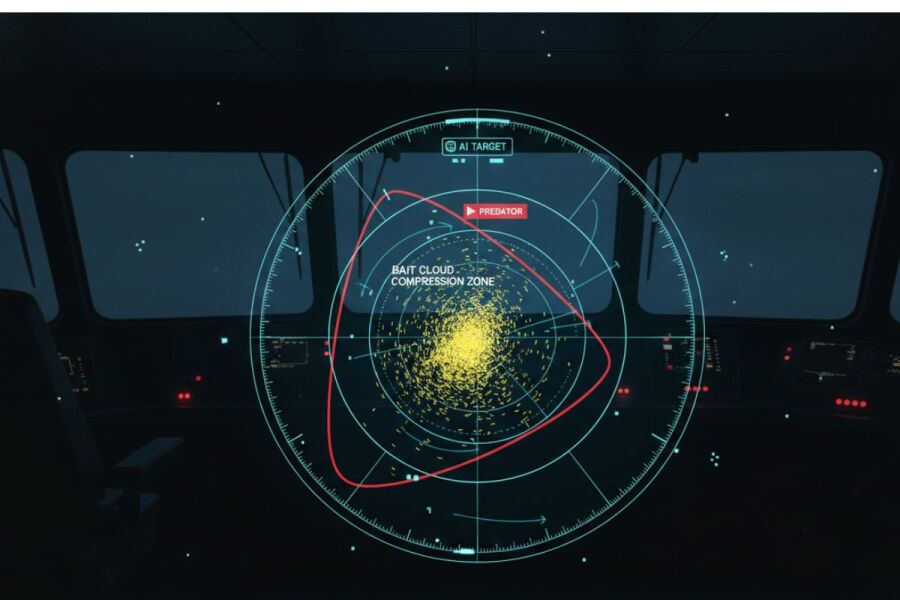
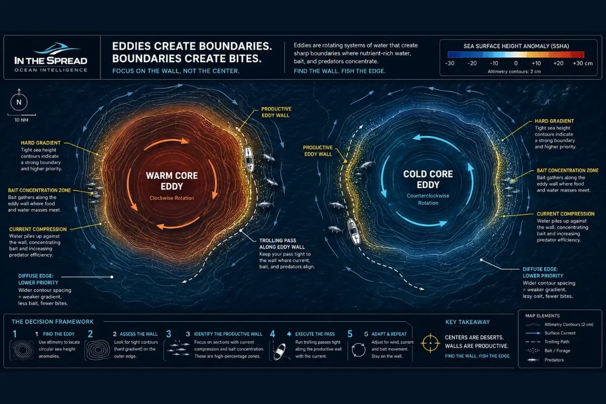
Eddy Analysis: Warm Core, Cold Core, and What Actually Matters
One common oversimplification in AI fishing content is describing eddies as always trapping warm, nutrient-rich water. The reality is more specific. Warm core eddies spin off from western boundary currents like the Gulf Stream and rotate clockwise in the Northern Hemisphere, carrying warm water and the bait and predators associated with it. Cold core eddies rotate the opposite direction and can upwell cooler, nutrient-dense water to the surface, creating a different but often equally productive biological environment.
Eddy productivity depends less on the temperature signature and more on the strength of the boundary between the eddy and surrounding water. A well-defined eddy wall with sharp temperature and color contrasts concentrates life along its perimeter. A decaying, diffuse eddy with softening gradients is often past its peak. AI altimetry-based eddy tracking helps you assess eddy strength and trajectory, which matters more than knowing simply that an eddy is present.
AI Sonar Technology: What the New Electronics Are Actually Doing
This section gets undersold in most conversations about AI in fishing, and it should not. The integration of machine learning into AI sonar fish finder technology is happening right now in units from Garmin, Simrad, and Furuno, and it represents a meaningful shift in what your electronics can tell you at the point of contact.
Traditional sonar returns an echo. You interpret the echo. AI-assisted sonar adds a classification layer. Specific capabilities now emerging or already present in higher-end units include:
- Distinguishing fish returns from baitfish from structure from noise, with improving reliability on size class and behavior patterns
- Biomass estimation for bait schools, helping you assess whether a school is large enough to be holding predators
- Adaptive gain and filter tuning that adjusts the display in real time based on conditions rather than requiring manual input
- Highlighting school formations that show patterns typically associated with feeding activity rather than passive suspension
One clarification worth making: species-level identification from sonar is still largely experimental. Current systems can distinguish size class proxies and behavioral signals with improving accuracy. Whether a return is yellowfin versus blackfin, or a wahoo versus a king mackerel, is not something these units reliably deliver yet. That distinction matters if you are making targeting decisions based on sonar returns. Size class and school behavior are the useful outputs right now. Species inference remains a future capability rather than a current one.
Thermocline Depth: The Layer That Surface Data Cannot See
Here is a scenario every serious offshore angler has experienced. The satellite map shows perfect conditions: clean blue water, a tight temperature break on the surface, an active chlorophyll edge. You run out there and the place is dead. The water looks right. The birds are absent. You grind around, try different headings, and eventually move or go home wondering what you missed.
A significant portion of those trips come down to thermocline depth. The thermocline is the boundary layer between warmer surface water and colder, denser water below. For species like yellowfin tuna and swordfish, thermocline position determines where in the water column fish are feeding and how accessible they are to your presentations. Surface conditions can look ideal while the thermocline sits so shallow that the productive zone is compressed to an unusable slice, or so deep that fish are holding far below where you are fishing.
Tools like the Fish Hawk and downrigger-mounted temperature probes give you real water column data that no satellite can provide. Some anglers are now pairing surface satellite analysis with water column profiling to build a three-dimensional picture of conditions before committing to a position. The AI and data platforms do not yet offer meaningful subsurface modeling at the consumer level. That is coming, but it is not here. In the meantime, understanding what the thermocline is doing remains one of the highest-leverage variables you can track on the water, and it is one that only in-water tools and experience can currently address.
AI Knows Where Better Than When
This is one of the clearest limitations in the current generation of AI fishing tools, and it almost never gets addressed directly. AI is reasonably good at narrowing your search area. It is much weaker at telling you the right moment to fish within that area.
Light penetration governs feeding behavior in ways the satellite data does not capture. Dawn and dusk transitions reliably shift how pelagic species are positioned in the water column and how aggressively they feed. Moon phase and lunar illumination affect nighttime bait activity and, as a cascading effect, where predators are positioned when the sun comes up. Barometric pressure swings preceding weather changes trigger or suppress feeding windows in ways that are difficult to model from historical correlations alone because feeding responses are often species-specific and condition-specific.
AI systems that deliver location probability are essentially telling you about geography. The temporal question, whether this is a morning bite, an incoming tide bite, or a post-front recovery bite, still requires angler judgment informed by species knowledge, seasonal patterns, and time on the water. A platform might correctly identify a productive eddy wall and be completely silent on the fact that the best hour on that wall is the first forty-five minutes after sunup when the bait is pinned against the current and the tuna are pushing from below.
Human Pattern Recognition vs. What AI Actually Does
This distinction is worth spending time on because it clarifies exactly what AI tools add to your decision-making and exactly where they stop being useful.
An experienced captain does not just recognize patterns. They understand causality. When they look at an SST break and decide to fish the south edge instead of the north, they know why that edge is likely better given the current direction, the bait migration timeline for the season, and the behavior of the target species relative to thermocline depth in that month. They can account for anomalies because they understand the mechanism behind the pattern, not just the pattern itself.
AI finds correlation. It identifies relationships in historical data and flags when current conditions match those relationships. That is genuinely useful. But correlation without causality breaks down in edge cases, unusual weather years, atypical current patterns, and any situation where the fish are doing something the historical dataset has not seen before. A good AI system can tell you this setup historically produces. An experienced captain can tell you why it might not produce today, despite matching the historical pattern.
There is also a scale problem that matters practically. AI is genuinely useful for narrowing a search area from fifty miles of potential water down to a ten or fifteen mile zone worth running. That is real value. But within that zone, finding the specific mile or two of water where the fish are concentrated on that day is still an eyes-on-the-water, sonar-reading, bird-watching exercise. The macro location problem is where AI helps most. The micro location problem, which often determines whether you catch fish or go home, is where experience and on-the-water observation still dominate.
What AI Cannot See: Radar, Birds, and the Tools It Does Not Touch
There is a workflow every experienced offshore captain runs that AI tools do not interact with at all, and it is worth naming because it illustrates where the technology boundary currently sits.
Radar in bird mode is one of the most reliable real-time fish-finding tools available offshore. A tight bird concentration working bait on the surface tells you something is pushing from below, and it tells you right now, not as a probability from a three-day-old satellite composite. The ability to distinguish a working frigate, a feeding tern school, and a loose scattered group of resting birds at range is a skill set that takes time to develop and that no current AI platform replicates or integrates.
Bird behavior, current rips visible from the bridge, weed lines, color changes you can see with your eyes, floating debris holding mahi, and bait marks on the sonar are all forms of real-time observational data that sit entirely outside the AI data pipeline. These are the signals that close the gap between the AI's ten-mile zone and the exact stretch of water worth slowing down for.
The Real Economics: How AI Changes Offshore Fuel Decisions
Fuel is the most tangible cost in offshore fishing, and it is where AI-assisted planning has some of the clearest and most measurable value. A long offshore run at rough-water speeds burns serious money. Running to the wrong area burns it for nothing.
Run optimization using oceanographic data is not a new concept, but AI tools have made it more accessible and more integrated into the trip-planning workflow. Specifically, the value comes in three practical areas:
- Pre-trip search area prioritization, so you run toward the highest-probability zone instead of returning to the last good waypoint out of habit
- Search grid efficiency once offshore, reducing the time and fuel spent running speculative patterns in dead water
- The discipline to recognize when the data says do not go. A poorly aligned oceanographic setup should influence your decision to run or hold. AI tools that aggregate multiple data layers give you better information for that call than gut feel alone.
The fuel savings from better location intelligence compound over a season. Anglers who run structured data-informed trips consistently report material reductions in fuel burned per productive day on the water. That efficiency argument alone justifies serious evaluation of the better offshore data platforms.
When Everyone Has the Same Map: The Information Saturation Problem
Here is something most AI fishing technology coverage ignores, and it is worth thinking about carefully. As these tools become more accessible and more widely adopted, the information advantage they once provided narrows. When the same satellite platform is telling thousands of anglers that a particular eddy wall is fishing well this weekend, that eddy wall gets crowded. Bite windows compress. The fish pattern shifts as pressure increases.
The competitive edge in AI-informed offshore fishing is migrating from data access to data interpretation. The tool itself is increasingly commoditized. What separates productive anglers is the ability to look at the same map as everyone else and draw a better conclusion about where within that zone the fish actually are, or to correctly identify a secondary opportunity that the algorithm ranked lower but that holds fish when the primary spot gets pressured.
Connectivity Offshore: What Starlink Changes and What It Does Not
Reliable offshore data access has historically been the practical limit on how much real-time AI analysis an angler could use while running or fishing. That is changing meaningfully, and Starlink maritime connectivity is the primary reason.
Starlink delivers broadband-class internet access far offshore at speeds that make data-intensive satellite platform updates genuinely practical underway. Captains who have installed it report real workflow changes: live updates of SST and current data mid-trip, communication with other boats, and the ability to pull fresh oceanographic data as conditions develop rather than relying entirely on the pre-departure briefing.
- Power draw is significant. A Starlink marine installation adds meaningful load to a vessel's electrical system and requires evaluation of alternator output and battery capacity.
- Hardware and installation cost is non-trivial, and the service subscription adds to the ongoing offshore operating budget.
- The flat-panel antenna has specific mounting requirements that do not suit every vessel configuration.
- Performance can vary with sea state. Pitch and roll on a rough day can affect signal stability depending on mounting position and antenna tracking. Network congestion in some offshore regions during peak season is also a real variable.
- Service is not universal. Performance characteristics depend on your latitude, your distance from land, and the local satellite constellation density in your operating area.
None of these is a reason to dismiss the technology. For serious offshore anglers who run long trips regularly and depend on current data, the calculus on connectivity hardware has shifted substantially in the last two years.
The Data Quality Problem Nobody Talks About
AI systems are only as reliable as the data behind them. In offshore fishing, that data has serious quality limitations that the platforms do not prominently advertise.
Historical catch data, which drives much of the pattern recognition behind AI fishing predictions, is characterized by three persistent problems. It is sparse: the ocean is vast and catch reporting from recreational anglers is inconsistent and incomplete. It is biased: the bulk of documented catch data comes from tournament circuits, charter operations, and well-trafficked offshore ports, so the models are disproportionately trained on heavily fished corridors and popular species. It is not standardized: different sources record catches in different ways, with varying levels of detail on conditions, depth, gear, and location precision.
A model trained on biased data reinforces biased assumptions. If the historical dataset overrepresents catches from one current system or one season type, predictions for atypical conditions will be less reliable than they appear. This is not a fatal flaw. It is a calibration issue that requires you to apply more skepticism when the prediction covers unfamiliar territory.
Where AI Offshore Fishing Technology Is Genuinely Heading
The near-term developments worth watching are less about headline-grabbing capabilities and more about practical integration and subsurface reach.
Unified platforms that consolidate satellite data, sonar output, navigation, and weather modeling into a single coherent interface are where the better technology companies are headed. Right now, most captains are context-switching between multiple tools to build a complete picture. Reducing that friction makes the whole system more usable in actual offshore conditions, where attention is limited and screen time is expensive.
AI sonar advancement will likely be the most significant near-term development for the on-the-water fishing experience. As size class discrimination, biomass estimation, and behavioral pattern highlighting improve in fish finder units, the information gap between what a top captain extracts from a sonar screen and what a developing angler sees will narrow. That capability is already shipping in current units from major manufacturers and improving with each firmware cycle.
Subsurface modeling is the longer-range development that would genuinely change the analytical picture. When AI systems can integrate water column temperature probe networks, acoustic data, and deep sonar returns into a dynamic three-dimensional ocean model, the surface-layer bias that limits current platforms will be addressed. The science exists. The infrastructure and consumer-level integration are the gap.
AI Fishing Technology: Common Questions Answered
What is the difference between AI fishing tools and traditional satellite fishing data?
Traditional satellite fishing data gives you static imagery of ocean conditions: SST charts, chlorophyll maps, and current overlays that you interpret manually. AI-integrated platforms layer these same data sources with pattern matching against historical fishing data, automated feature identification such as eddy tracking and gradient detection, and in some cases predictive modeling for how conditions are likely to develop. The core satellite data is often similar. The difference is in how quickly the platform processes it, how many layers it integrates simultaneously, and what additional context it provides about what those conditions historically produce.
How fresh is the satellite data in AI fishing apps?
Fresher than many anglers assume, but not as current as the live-update language implies. SST imagery from passive microwave satellites typically carries a six to twenty-four hour lag and degrades under cloud cover. Chlorophyll composite maps are often assembled over one to three days to fill coverage gaps. Altimetry data used for eddy tracking operates on a multi-day refresh cycle. Use satellite data as a planning foundation and understand you are looking at recent history, not a live feed.
Do fish finders use AI?
Increasingly yes, though capability varies significantly between units and manufacturers. Higher-end units from Garmin, Simrad, and Furuno are incorporating AI-assisted target classification by size class and behavior, biomass estimation for bait schools, and adaptive display tuning. True species identification from sonar is still largely experimental at the consumer level. If AI sonar capability is a factor in your next electronics purchase, confirm specifically which features are AI-driven versus conventionally processed in the units you are evaluating.
How does thermocline depth affect AI fishing predictions?
It does not, currently. AI fishing platforms rely almost exclusively on surface-layer satellite data and do not incorporate real-time thermocline depth or water column structure. This is a meaningful gap because thermocline position directly influences where species like yellowfin tuna and swordfish are holding in the water column. Surface conditions can look ideal while thermocline dynamics make the water unproductive. Pairing AI satellite analysis with in-water temperature profiling tools gives you a more complete picture than satellite data alone.
Why does AI fishing data seem accurate for location but miss the bite timing?
Because AI systems are trained primarily on spatial data: where fish were caught under specific oceanographic conditions. Temporal variables like light level, moon phase, barometric pressure trends, and time-of-day feeding windows are harder to model reliably and are underrepresented in most historical catch datasets. AI narrows your geography. When to fish within that geography still depends on species-specific knowledge, seasonal experience, and conditions you observe on the water.
Is Starlink worth the investment for offshore fishing?
For captains and serious offshore anglers who run regular trips and rely on current oceanographic data, the connectivity Starlink provides has changed their ability to receive live updates and communicate offshore in ways that older satellite systems could not match economically. The honest evaluation involves your vessel's electrical capacity for the power draw, your mounting configuration, expected sea state in your operating area, and your operating budget. For occasional offshore anglers, the cost-benefit calculation is different. The technology is real. Whether it makes sense depends on how often and how far you fish.
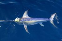
Does AI help with wahoo fishing specifically?
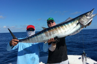
Wahoo are highly current-oriented and concentrate predictably along sharp temperature breaks and clean current edges near offshore structure. AI satellite systems that identify these boundaries with strong resolution are directly applicable to wahoo trip planning. Getting the wahoo fishing execution right once you are in position, including trolling speed, lure selection, and search pattern relative to the break, is where technique takes over from technology.
The Advantage Is Still in the Hands
AI fishing tools have genuinely improved how well-prepared offshore anglers can be before the lines go in. The oceanographic picture is clearer, the pattern recognition is faster, and the integration of data sources that used to require multiple subscriptions and manual cross-referencing is more accessible than it has ever been.
What has not changed is where the margin actually lives. The captain who looks at the same map as three other boats and fishes a different part of the eddy wall because they understand why the upcurrent side is more likely to hold fish on an incoming tide is not winning because of the tool. They are winning because of what they know. The Fishing Video Courses at In The Spread exist for exactly that reason: to develop the species knowledge, oceanographic reading ability, and technique execution that make every piece of data you gather offshore actually useful.
Login
to leave a review.
User Reviews
There are no reviews yet.
Complete Dredge Pulley Setup Guide
Saltwater
12.28.2020
High Speed Wahoo Trolling Rig
Saltwater
09.08.2018
Fishing Light Tackle for Yellowfin Tuna
Saltwater
09.08.2018


Fishing Gulf of Mexico Inshore Waters
Saltwater
11.28.2023
0